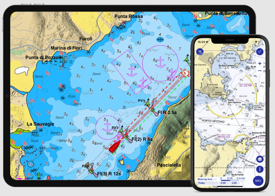
Navigating the vast and unpredictable seas has always required precision, knowledge, and the right tools. Among these essential tools, marine navigation charts stand out as the linchpin for safe and efficient sea travel. These charts not only depict the underwater terrain and features but also serve as a navigator’s roadmap, guiding vessels away from danger and towards their destinations. This blog delves into the undeniable benefits these charts offer to the maritime industry.
Enhanced Safety at Sea
One of the paramount advantages of marine navigation charts is the significant enhancement of safety they provide. These charts detail potential hazards, including shoals, wrecks, and submerged rocks, that could pose threats to safe navigation. By meticulously plotting a course with these charts, mariners can avoid dangerous areas, reducing the risk of maritime accidents. This preventive measure is vital in ensuring the safety of the crew, cargo, and vessel, especially in uncharted or poorly mapped waters.
Efficient Route Planning
Efficiency in navigation is not just about reaching the destination but also about doing so in the most time and fuel-efficient manner. Marine navigation charts enable sailors to plan routes that take into account tidal patterns, currents, and weather conditions. This strategic routing prevents unnecessary fuel consumption and time wastage, leading to more economical voyages.
Compliance with Marine Regulations
The International Maritime Organization (IMO) and other regulatory bodies have set forth numerous requirements to promote safety and environmental protection in maritime operations. Utilizing updated marine navigation charts is a critical aspect of adhering to these regulations. Vessels found without the necessary, up-to-date navigation charts may face legal and financial repercussions.
Accessibility through Digital Solutions
The advent of marine navigation charts online has revolutionised access to necessary navigational data. Mariners can now obtain the latest updates on maritime topography, navigational aids, and pertinent maritime safety information with just a few clicks. This instant access ensures that navigational strategies can be adjusted in real-time, providing a dynamic approach to maritime navigation that enhances both safety and efficiency.
Conclusion
In the realm of maritime navigation, the importance of marine navigation charts cannot be overstated. They are not just tools for guidance but are fundamental to conducting safe, efficient, and regulation-compliant maritime operations. The evolution of digital access through navigation charts online further underscores the critical role these charts play in the modern seafaring landscape. By harnessing the insights and capabilities these navigational resources offer, the maritime community can continue to push the boundaries of what is possible on the open seas, ensuring safer and more sustainable voyages for all.

